

Od poniedziałku do piątku
9:30 - 16:00
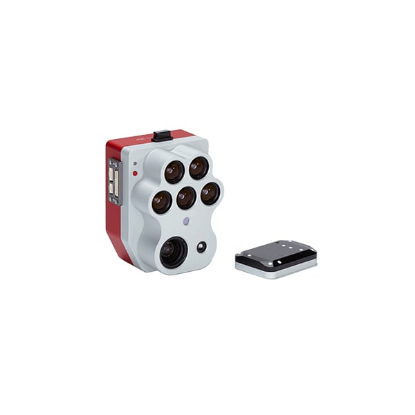

MicaSense Altum PT – an innovative camera for comprehensive environmental analysis
Altum PT by MicaSense is an innovative drone sensor for forestry and agriculture. The multispectral camera allows for accurate representation of the morphological features and surface temperature of plants. A set of 7 precise sensors, including one LWIR and one panchromatic, make up a comprehensive tool for diagnosing plant cover. The camera’s capabilities are complemented by twice the spatial resolution and twice the data recording speed. All this makes Altum PT set a new standard in low-level multi-channel imaging technology.

MicaSense Altum PT drone camera for forestry and agriculture – excellent image quality
The Altum PT sensor is an optimal tool for specialists in industries related to vegetation management. The Altum PT multispectral camera is chosen by farmers who use the entire growing season for plant production, and foresters who manage ecosystems with a very diverse species and age structure. It is also suitable for gardeners and fruit growers who prefer all varieties of fruit and vegetables. It complements the work of scientists in the breeding industry, as well as specialists in growing crops on organic substrates.
The Altum PT camera is able to take high-resolution photos in 6 spectral bands simultaneously. It allows you to obtain the data necessary to develop, among others:
maps of land cover by plants,
a detailed map of the content of plant dyes,
maps of the health status and development phase of plants,
vegetation index maps, i.e. NDVI, NDRE, ENDVI, SAVI, MSI, MCARI, GDVI and others,
active surface temperature distribution maps,
potential ETP evaporation maps,
topsoil moisture maps,
orthophotomosaics (multi-channel raster),
DSM maps based on a dense point cloud.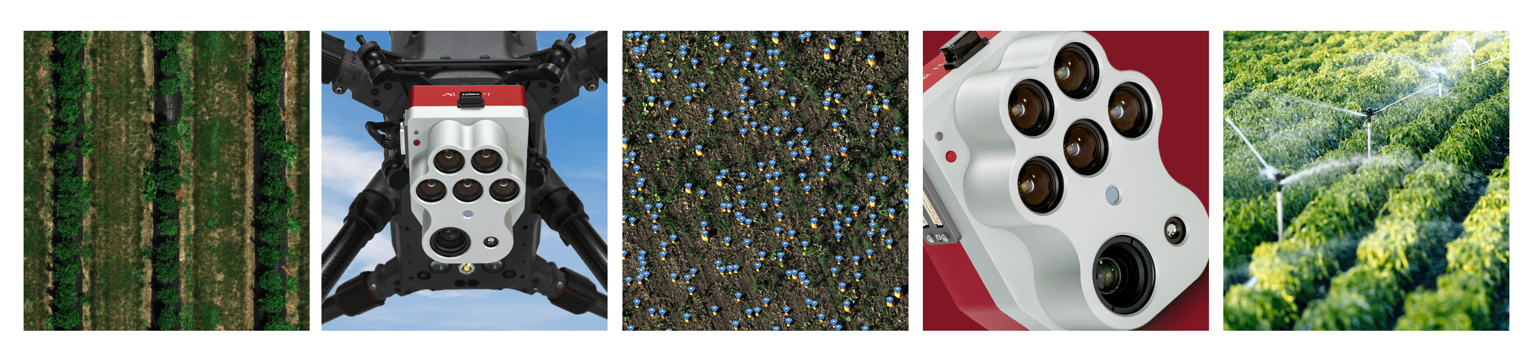
Altum PT – an extremely precise multispectral camera for a drone
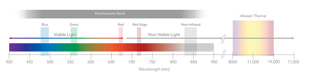
Thanks to the global shutter, the image obtained with MicaSense Altum PT is distortion-free. Thanks to this, it is possible to flawlessly combine all spectral bands into a clear, colorful orthomosaic. The advantage of the camera is its quick and simple integration with many flying platforms, both rotors and airframes. Compatibility with the SkyPort V2 system provides access to RTK and PPK data of flying platforms. This additionally increases the value of studies in the field of precision agriculture. Thanks to the low energy demand and the efficient processor, it is possible to record images in the full spectrum of visible radiation and 5 spectral channels, as well as LWIR (Long-Wave Infrared) simultaneously.
Much greater capabilities of the Altum PT camera
A fast processor allows you to take photos during unmanned aircraft flights at higher speeds than before. It allows you to move not only over large areas, but also at higher altitudes, while maintaining data integrity and high quality photos (2.49 cm/pix 120 m AGL). This solution opens up new possibilities, especially for airframes and hybrid structures. In scientific research and phenotyping experiments, the camera increases efficiency when collecting data over small surfaces to obtain a resolution similar to that obtained with plant scanners or PPS (Plant Phenotyping System) devices.
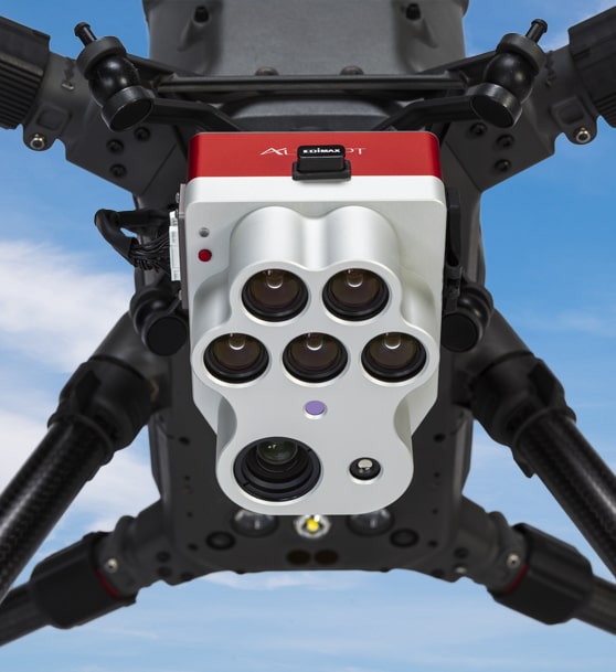
Altum PT compatible with DJI platforms
The Altum PT camera is compatible with DJI Matrice 600 Pro drones and the Matrice 200, 210 series, as well as the DJI Matrice 300 RTK model. Moreover, thanks to its enormous capabilities, we can use it as an independent multifunctional sensor for comprehensive environmental analysis. The new version of the camera uses a very fast processor. Thanks to this, data acquisition is twice as fast compared to the previous version. Moreover, the optimized image compression algorithm allows you to upload photos to the cloud in a very short time.
The most important features of the Altum PT drone camera:
All MicaSense series sensors are NDAA (USA NATIONAL DEFENSE AUTHORIZATION ACT) compliant – designed and manufactured in the USA
Multispectral camera compatible with drones of many brands
5 spectral channels (3.2MP each) + thermal sensor + panchromatic sensor
12.4 MP high resolution panchromatic sensor ;
spatial resolution of multispectral data after Pansharpening: 1.25 cm per pixel (60 m height) / 2.5 cm (120 m height)
radiometric FLIR thermal sensor (33.5 cm/pixel GSD at a height of 120 m)
DLS 2 – light intensity sensor with built-in GPS (8 integrated light sensors and 12 directional sensors)
The multispectral kit includes:
Altum-PT camera
DLS2 light sensor with built-in GPS
CRP2 panel
USB Wi-Fi modem
Lens hood
Wiring
Fitting elements
CFexpress card
CFexpress card reader
Case
Instructions
Reviews
There are no reviews yet.